Quality Living in the North Carolina and North Georgia Mountains
Cherokee County NC • Clay County NC
Fannin County GA • Union County GA • Towns County GA
The North Georgia and Western North Carolina Mountains are an ideal place to relocate or retire to, as well as a great place to invest in a 2nd home-mountain getaway. There are four full season with mild to moderate weather. The cost of Real Estate in the mountains is very reasonable compared to the national average making mountain property a great value.
Cherokee County North Carolina • Murphy • Andrews • Marble • Brasstown
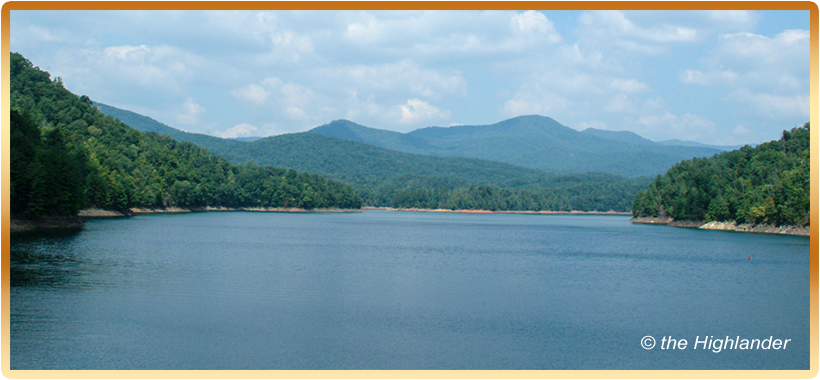
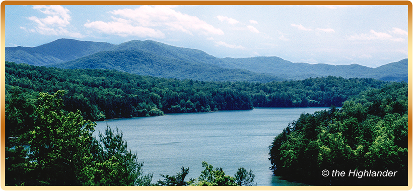
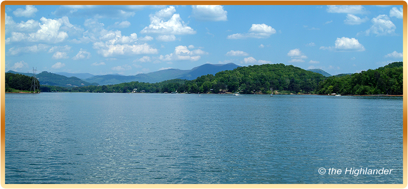
Cherokee County is a land where the rivers converge. Flowing southwest through Andrews, the Valley River leads us back down the valley to Murphy where the Valley River flow into Hiwassee Lake. The Hiwassee River cuts directly through Murphy and flows northwest into Hiwassee Lake. Flowing north from Union County, Georgia the Nottely River, also flows into the broad channels of Hiwassee Lake, in northern Cherokee County. Hiwassee Lake's northern shores are located below the southwest region of the remote Unicoi Mountains. The waters of the Hiwassee River continue to Appalachia Lake and exit the Appalachia Dam at the very edge of the states of North Carolina and Tennessee. Here the river bends and joins an extraordinary engineering feat, created by a turn of the century railroad to follow the picturesque Hiwassee River through the mountains and into the Tennessee River Valley.
Keeping the Unicoi Mountains to our north, we travel deeper into Cherokee County, across the country side until we come to the intersection of US 64 and State 294. Here you'll notice a sign going north stating, "Fields of the Wood." Fields of the Wood is a spiritual retreat, emphasizing the teaching of the Bible. Like the Bible, Fields of the Wood is bigger than life. You'll find the Ten Commandments laid out on the side of the mountain, a display of the flags of the world in the shape of a cross on the mountain top, several reproductions of structures from the Holy land. A biblical teaching path leads you up the steps of a mountain trail to an overlook and a small grass covered landing strip. The Fields of the Wood is open to the public year-round, free of charge, although, donations are welcomed.
Murphy: The town of Murphy was founded on the banks of the Hiwassee River and named after Colonel Archibald D. Murphey. Fort Butler, located in Murphy, was the largest military fort in Western North Carolina and was one of six forts built under the orders of President Jackson for the purpose of the removal of the Cherokee tribes.
Murphy is known as either the first or last town in North Carolina, depending on which way you’re going or coming from. River commerce, and the later arrival of the railroad, made Murphy the ideal location for establishing the Cherokee County Seat. The regal blue marble County Courthouse was built with stone blocks quarried locally in the nearby community of Marble.
Andrews: It's rare to find natural flat terrain deep in the mountains, Andrews is the exception to that rule. The lush valley floor surrounding Andrews was ideal for agriculture, an obvious draw to early settlers. The dramatic backdrop of Andrews is the magnificent Snowbird Mountains. Andrews grew and prospered with the completion of the Richmond and Danville Railroad in the spring of 1890. The town is named after the railroad's second vice president, Colonel A.B. Andrews.
The Main street is made up of several blocks of mostly brick buildings with several large, turn of the century homes. Most notable are the vintage mansions along the tracks just parallel to Main street.
Marble: Bordering this fertile valley are two long mountain ranges, within an elongated valley with a remarkably flat valley floor of prime farmland. The northern mountain barrier is made up of the Snowbird Mountains, which is an eastern extension of the Unicoi Mountains. The southeastern mountain range is the Valley River Mountains, which is a western extension of the Nantahala Mountains. These two mountain ranges converge at the upper north end of the valley forming what is called the Nantahala River Gorge.
Brasstown: This quaint little town is located in both Clay County and Cherokee County. Brasstown is the home of the world-renowned John C. Campbell Folk School and the Historic Mountain Valley Creamery. The school represents the preservation and teaching of mountain folk art. The Historic Creamery is currently being restored and is the home of Highlander Gallery.
Clay County North Carolina • Hayesville • Brasstown • Tusquittee Valley
From the shores of beautiful Lake Chatuge to the peak of mile-high Standing Indian Mountain on the outskirts of the county. Clay County is considered one of the unspoiled hideaways of the Blue Ridge Mountains. Ancient mountain trails, tall timber hardwood forest, crystal clear streams make this region a natural mountain experience. It’s ideal small towns have become a natural haven to the creative minds of artists looking for a place to express the gift of their imaginations. The western and southern views of the mountains are breathtaking. The two mountains to the south, Hightower and Eagle Mountain display great perspective in size, making all else appear small and insignificant.
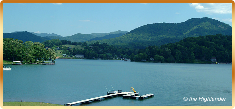
The northern end of Lake Chatuge is in North Carolina while the south side of Lake Chatuge is in North Georgia, about 10 miles away. Its southern shores are in the Chattahoochee National Forest and its northern shores in the Nantahala National Forest.
Hayesville: This is a very charming little town whose town square contains both an old red brick courthouse next to a picturesque park, complete with a gazebo. The main streets around the square consist of numerous stores, many them have continuous overhead-porches giving a feel of that old general store experience.
Brasstown: This quaint little town is located in both Clay County and Cherokee County. Brasstown is the home of the world-renowned John C. Campbell Folk School and the Historic Mountain Valley Creamery. The school represents the preservation and teaching of mountain folk art. The Historic Creamery is currently being restored and is the home of Highlander Gallery.
Tusquittee Valley: To the north of Hayesville is a beautiful valley surrounded by high mountains. You'll find a lot of open pasture lands and meadows, laden with scattered homes and estates. It's a great place to find that creative inner-self.
The lands of Clay County to the west are made up of rolling hills within the river valley, and small mountain backdrops to the pastures and farmlands.
Fannin County Georgia • Blue Ridge • McCaysville • Morganton • Mineral Bluff • Epworth • Dial
Fannin County is composed of nearly half National Forest and Wilderness Area. The Cohutta Wilderness contains approximately 40,000 acres of forest land, and is the largest National Forest Wilderness in the Eastern United States. Old logging roads, now forestry roads are the only way in or out. This doesn't prevent the true wilderness enthusiast, or four-wheeler from the remote discoveries Fannin County has to offer.
Considered the gateway to the mountains, this community is conveniently located just 1.5 hours north of Atlanta. Lake Blue Ridge and the Toccoa river, both located in Fannin County, are the head waters of the infamous Ocoee River, in Polk County Tennessee.
The county was named after Colonel Fannin who fought and died bravely with his troops at Goliad Texas, just miles from the famed Alamo.
Blue Ridge: The town has grown and prospered in both commerce and tourism since its founding, with the coming of the railroad in 1887. Unique, art galleries, antique shops, furniture galleries, specialty shops, and eateries make this a wonderful experience in leisurely shopping and dining, any time of the year.
The old railroad depot is listed on the National Registry of Historical Places. The depot is a center piece of the town, representing the grand days at the turn of the century. At that time, Blue Ridge was the hub of excitement for real estate development and tourist, who traveled here to enjoy the beauty of the mountains and the refreshing mineral springs.
McCaysville: This town hugs the state line where Georgia meets Tennessee. At this exact point, the waters of the Toccoa River become the beginnings of fast flowing, intensely powerful, white water rapids of the Ocoee River. The town's main thoroughfare is made up of one and two story buildings on both sides of the street. The area is referred to as the Copper Basin Area, and it is a two for one experience. Across the street or should I say across the state line you'll find Copperhill Tennessee, an old copper mining town, that in its time provided a stable income to both sides of the state line.
Mineral Bluff: This is a quaint little residential town made up of a church, post office, school and several historical homes. Mineral Bluff predates Blue Ridge. With the coming of the railroad, Mineral Bluff prospered and grew into a tourist attraction due to its healthy mineral springs.
Morganton: Until the train was built through Blue Ridge, Morganton was designated as the county seat of Fannin County. Morganton is on the northwestern shore of Lake Blue Ridge, is mostly a residential community today.
Epworth: Originally a farm community, today Epworth is a residential community with an old country store and post office. Epworth is located on the route between Blue Ridge and McCaysville.
Dial: This residential community hasn't changed a bit in 100 years. Dial consists of a small country store and the beautiful banks, of the upper Toccoa River. It is a modest town hidden in the upper reaches of a remote valley in the steep mountains of southern Fannin County.
Union County Georgia • Blairsville • Suches
The Appalachian Trail crosses over many of Union County's mountain peaks, making the trail accessible at several locations where main roads cross mountain gaps. This allows a hiker the ability to enjoy day long hikes where they can enter at one point, and exit at another.
Another interesting feature within the Brasstown Mountain Range is the Trackrock Archaeological Area. This 52-acre preserve contains numerous stone embedded pictographs of Ancient Native American origin. They are estimated to be over 10,000 years old.
Nottely River flows north from the high mountains of southern Union County, joining Coosa Creek and various other streams as they make their way to the banks of Lake Nottely in north central Union County.
Union County is known as the top of North Georgia with Brasstown Bald Mountain Range and Wilderness Area, towering at 4,784 feet. The tower and observation platform offer a magnificent 360-degree view when the visibility is clear. From Brasstown Bald looking south towards Hogpen Gap and westward to Blood Mountain you'll find a majestic area of mountain trails, waterfalls, and illuminating flora displays. Native American tales and legends as well as historical sites of early European Explorers dating back nearly five hundred years can be found throughout Union County.
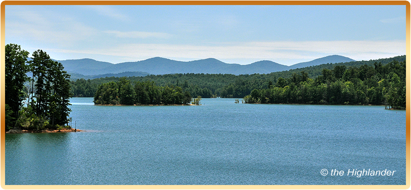
One hundred and fifty miles of shoreline make Lake Nottely a favorite for boating, fishing and other water recreation. Union County also has 97,800 acres of the Chattahoochee National Forest as a backyard playground for the land lovers.
Gold is the reason they originally came. Today, it's the National Forest that draws many visitors to Union County, Georgia. Chattahoochee National Forest occupies more than 50% of Union County.
Blairsville: The historic Romanesque designed courthouse built in 1899, is the center piece of Blairsville. The sharp rap of the gavel is no longer heard within the walls of the old courthouse, this building has been converted to be the home of the Union County Historical Society and Museum.
Suches: A high mountain valley, remote and tranquil best describes this community. Residents find this to be a great escape from the hustle and bustle of city living, a true place out of the past were time stands still.
Towns County Georgia • Hiawassee • Young Harris
Brasstown Valley and neighboring Lake Chatuge are extraordinary examples of the beauty that is contained within the rugged mountain peaks of the Blue Ridge Mountains in Towns County, Georgia.
Traveling east on US 76, across a gap north of Cedar Cliff Mountain, you'll behold "the Enchanted Valley." As the highway drops before you, the mammoth mountain ranges of the Nantahala National Forest are to the northeast. As you continue to glide down the sloped pavement, you'll begin to see the turquoise blue waters of Lake Chatuge.
Once you've enter the Enchanted Valley you will be overwhelmed by its beauty. The entire center of the valley is composed of a 7,500-acre lake lined with forests and lake-shore homes. It’s completely surrounded by high mountain peaks. The mountains to the north, across the lake are the Nantahala Mountains of North Carolina. To the south and east are the mountain peaks of the Chattahoochee National Forest with several access points onto the Appalachian Trail.
Contained within the Chattahoochee National Forest in Towns County, you'll find the rugged back country of Brasstown and Tray Mountain Wilderness. To the southwest you'll find Brasstown Bald.
The Appalachian Trail traverses along the southern mountain ridges of the Chattahoochee National Forest, high above the Enchanted Valley. Turning north along the southeastern regions of Towns County, near the Rabun County Lines, on US 76 you'll reach Dick's Gap and a crossing and entrance to the Appalachian Trail.
You can follow the southern shores of Lake Chatuge along US 76. The lake flows north from Georgia into North Carolina. This section of Towns County is considered the heart of the North Georgia mountains.
Within a 170-acre area is a succession of five waterfalls that have an estimated total vertical drop of 300 ft. The 1.2 mile, High Shoals Trail follows along the High Shoals Creek to observation decks besides two of the five streams within this scenic area.
Hiawassee: Resting on the southeast shores of the beautiful Lake Chatuge is the town of Hiawassee. The town has has grown with popularity, over the years. Georgia Mountain Fairgrounds is located in Hiawassee, which boasts a concert theater that draws big named performers from the world of Country Music. Towns County has a vast array of activities from rugged back country to leisure time getaways.
Young Harris: This small mountain community has incredible charm. The most valuable historical asset in this town is the old picturesque Young Harris College. The old historic campus buildings make this a rare and beautiful experience for visitors, students and faculty.
Photos and Copy ©the Highlander